


Although I have been to Moab, Utah and by extension, Arches National Park, numerous times, I’ve always seemed to miss spending any time in Canyonlands National Park. It’s about a 30 minute ride from Moab and yet it has taken me years to finally get here. I took part of a day on my latest adventure to Moab to remedy this fact and I am kicking myself. Canyonlands is considerably bigger than Arches, actually almost five times the size. With 337,598 acres the park is divided into four main districts; Island in the Sky, The Needles, The Maze and The Rivers. There are only a few “roads” that connect the districts together and most of them are four-wheel drive rated. From Moab, the easiest district to get to is Island in the Sky and that is where the adventure, albeit short, begins.

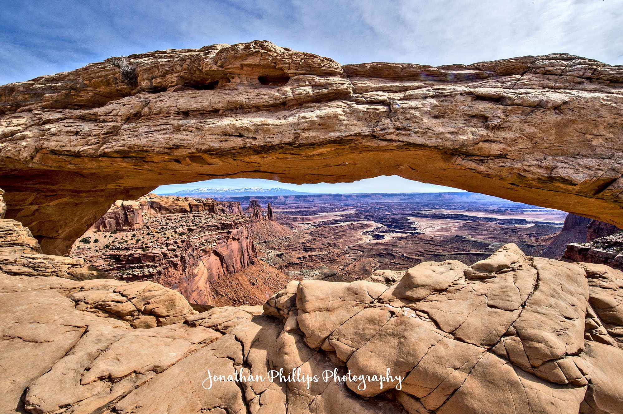
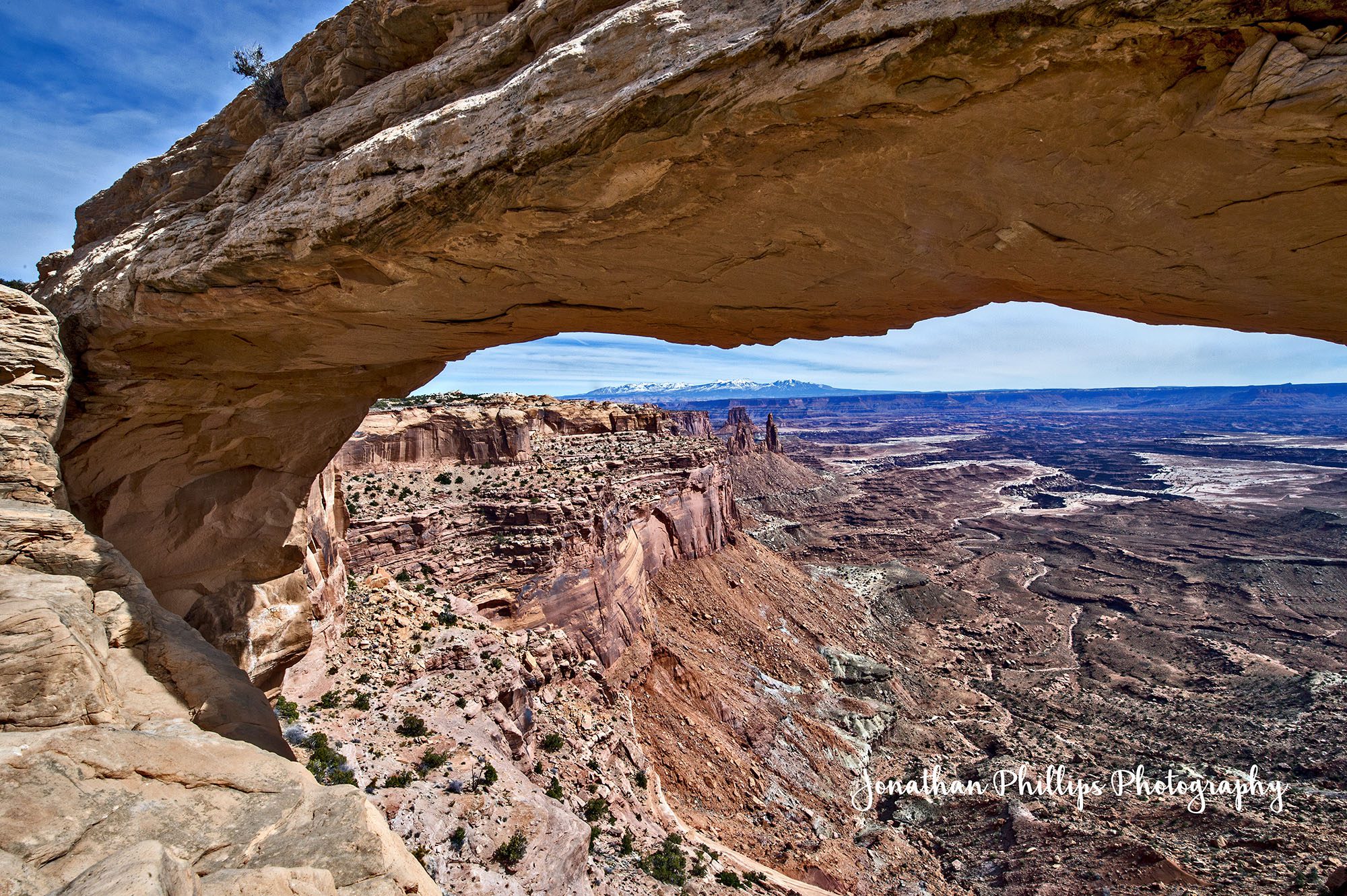
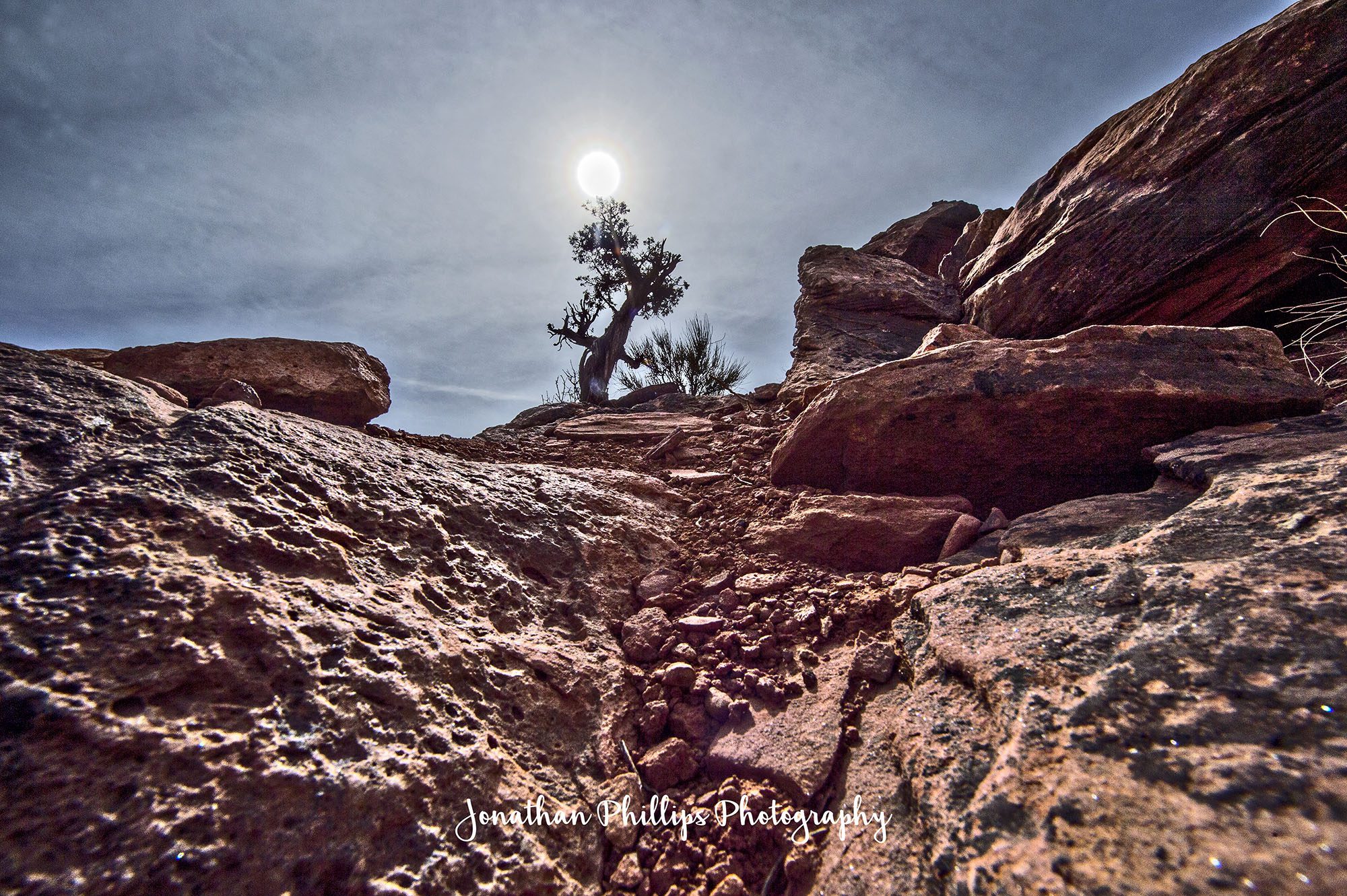
Island in the Sky is aptly named because this section of Canyonlands is on top of a large mesa that is 1,000 feet higher than the surrounding canyons below with a lot of vertigo-inspiring, sheer sandstone cliffs. There’s a bunch of trail options and pull offs that give spectacular views and after making a quick stop in the visitors center I decide on three of the main attractions, so to speak. The first stop is Mesa Arch, a pothole arch that frames the surrounding canyons and mountains in a perfect picture from high atop a cliff. The trail leading to the arch is only .8 miles. It’s easy, well marked and has little elevation gain. The trail almost immediately splits from the parking lot. Going straight would have taken me on a direct path to the arch itself but I choose to branch left. There’s no one else going this way and I want a little more solitude. I am rewarded with just that and a small bonus as this part of the trail has been marked with an arboretum of sorts. The different trees, grasses and shrubs have placards giving descriptions of what they are. I am introduced to, among other things, Snake Grass, a living fossil, the last of a species genus that dates back to the Paleozoic period over 100 million years ago. I know I am a geek but I love this kind of stuff. The path twists and turns through the high desert and at last I arrive at the arch. It’s smaller than I expect but unlike the towering expanses in Arches National Park, I can almost reach out and touch it. The view of the canyons below and the La Sal Range in the background are indeed perfectly framed within it’s 50 foot stretch across a 500 foot vertical cliff. Again being before the high season there aren’t too many people around and it’s easy to snap a few postcard worthy photographs. I sit and take in the beauty around me, staring through the archway at the sweeping landscapes of Utah. Back on the trail and again I am awarded a little something extra with a mostly downhill descent back to the trailhead.

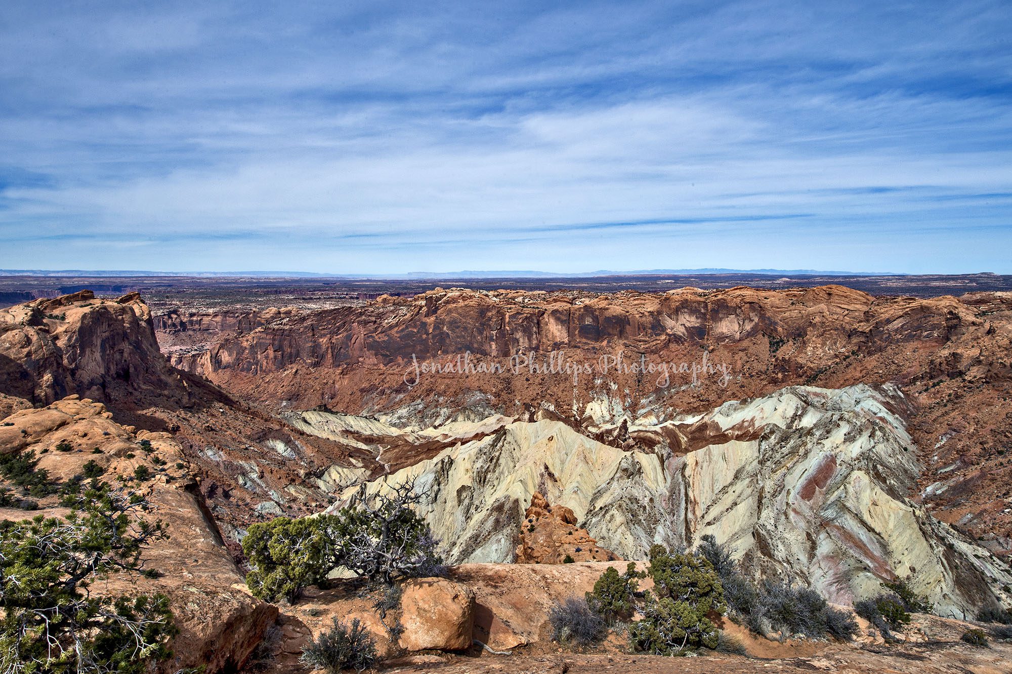
The next stop is Upheaval Dome to the northwest of the park. This geological anomaly is hard to describe. There is science behind what has happened and there are two leading theories as to how the dome formed. The first is that the dome is actually a salt bubble that has risen to the surface after a few million years of pushing its way through the sandstone surrounding it. The forces at work leave the surrounding rock around the bubble deformed. The second theory is that the dome is a meteorite impact crater. A meteorite with a diameter of approximately one-third of a mile hit at what is now the Upheaval Dome. The impact created a large explosion, sending dust and debris high into the atmosphere. The impact initially created an unstable crater that partially collapsed. As the area around Upheaval Dome reached an equilibrium, the rocks underground heaved upward to fill the void left by the impact. However Upheaval Dome came to be, it looks like the top of a mountain peak has popped through the center of a three mile canyon. The salt shines green and white in absolute contrast to the red hues of the surrounding rock walls. Shortly after leaving from the trailhead, there are actually two intersecting trails. The Syncline Loop is a little over eight miles and follows the canyons around the dome. It is labeled as strenuous and requires route-finding, climbing and scrambling through boulder fields, and steep switchbacks with 1,300-feet of elevation change. It is marked and you’ll see it off to the left with narrow and steep steps off of the main trail. The main trail, which is what I opt for with my time crunch, leads up a moderate path marked by steps and cairns as it climbs 100 feet in elevation traversing some open spaces and slick rock before finally opening to a wide open view of the dome. I walk out onto the slick rock and look out to see the tumultuous landscape and ponder its creation. I’m no scientist but it sure does resemble an impact crater if you ask me.
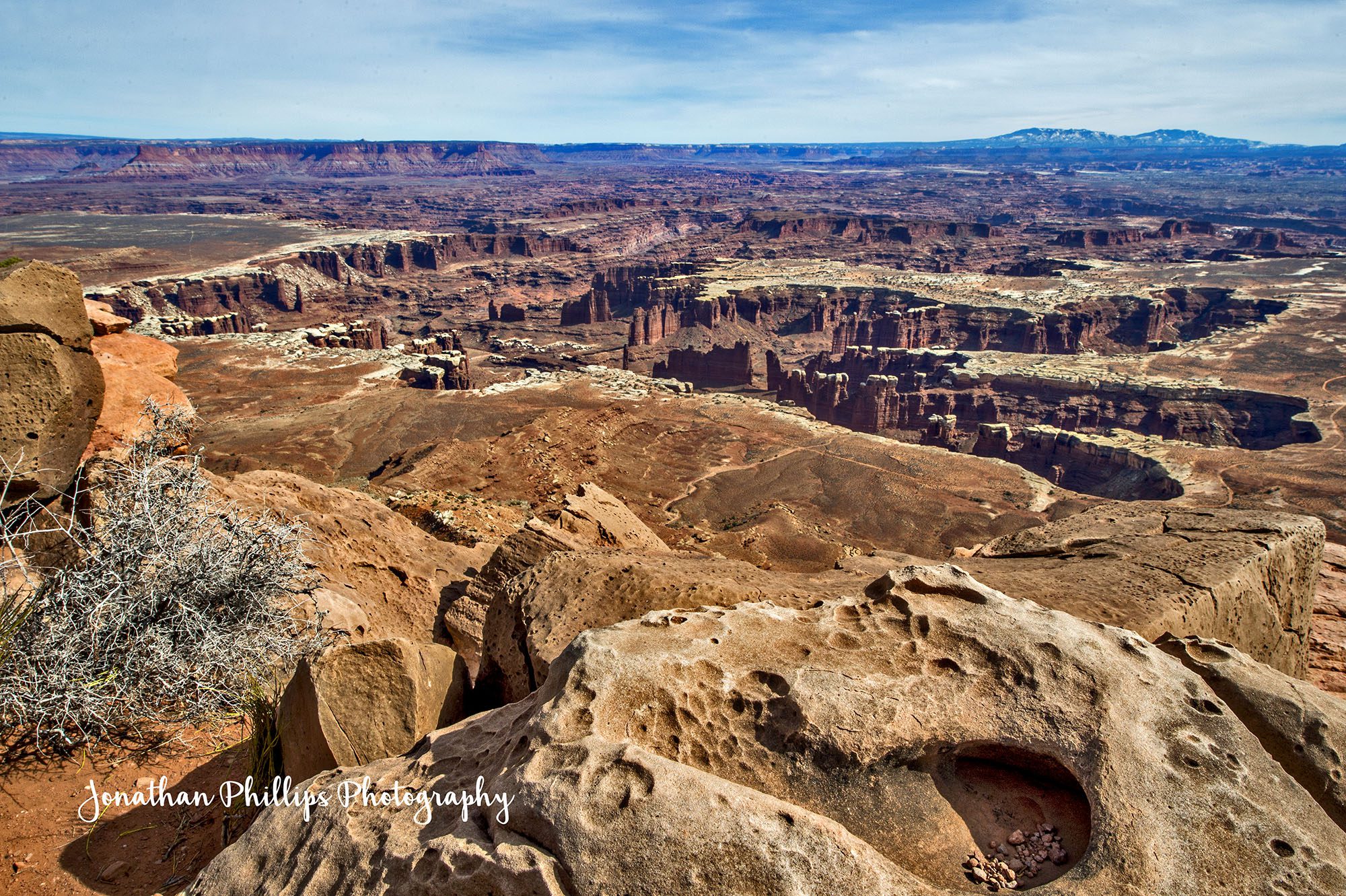
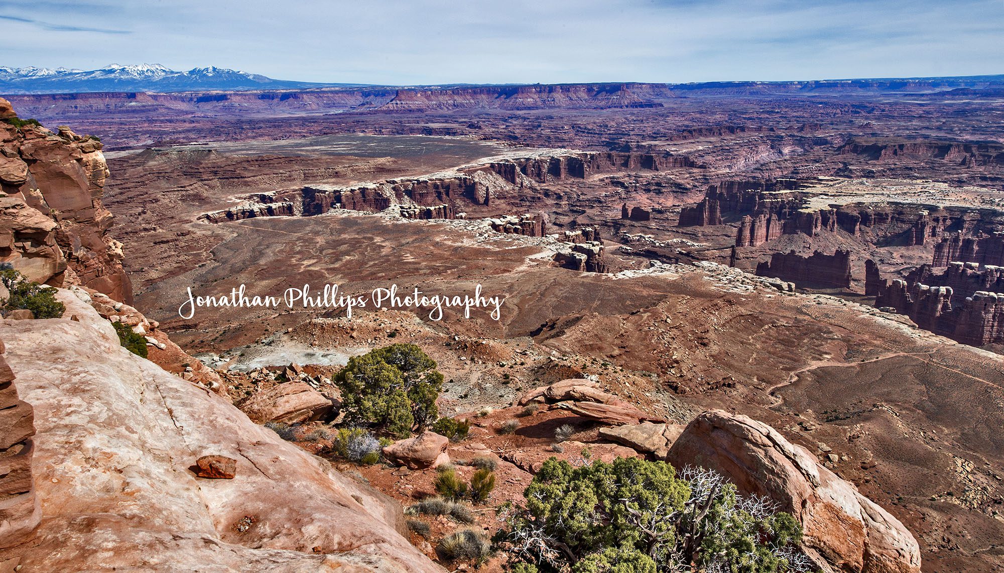
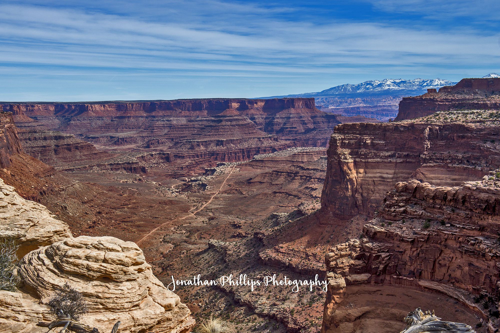
I want to be sure I have enough time to reach the Grand Mesa, my third stop, before it gets too late in the day so I opt out of hiking to the second overlook for the dome. Instead I head back down the trail and across more gorgeous, alien landscape. I stop at a few of the overlooks before reaching my final destination. More deep canyons, mountains, mesas and sheer cliffs pass before my eyes but they all pale in comparison when I first see the Grand Mesa. To me, taking in this view is awe-inspiring, and feels like the first time I saw the Grand Canyon. The landscape seems to go on forever. Deep canyons sit in blackness, glints of the Green and Colorado rivers sparkle in the sun and mountains sit on the horizon faded in hues of blue. All I can say is that I have so much more to explore in this park and I will definitely be back…